Scientists are zooming out to get a more complete global view of volcanic eruptions—1.6 million kilometers out, to be precise. That is the distance to the Deep Space Climate Observatory (DSCOVR), a satellite originally conceived by former vice president Al Gore. Using an instrument onboard DSCOVR that can detect gases belched by volcanoes, researchers can now take snapshots of eruptions every one to two hours. Monitoring these events, which often spew ash that can trigger engine failure in airplanes, can help scientists quickly pinpoint potentially dangerous airspace.
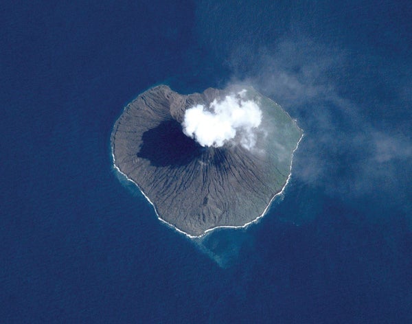
Many of Earth's roughly 1,500 potentially active volcanoes are in remote areas, so it can be difficult to regularly study ongoing eruptions or identify new ones, says Simon Carn, a volcanologist at Michigan Technological University. “U.S. volcanoes are pretty well monitored, but elsewhere it's a different story,” Carn adds. “There's definitely a need for satellite monitoring.”
Carn and his colleagues used DSCOVR's Earth Polychromatic Imaging Camera (EPIC) to observe 16 eruptions. They collected ultraviolet measurements of sulfur dioxide (SO2), a gas frequently emitted by volcanoes. Sulfur dioxide is the easiest volcanic gas to measure because it is relatively rare in the atmosphere, Carn says. The EPIC observations provided a new view of Earth's surface every 68 to 110 minutes—much more frequently than most other ultraviolet satellite instruments. “Eruptions can evolve rapidly, so the higher the frequency of observations, the better our ability to track them,” Carn says.
On supporting science journalism
If you're enjoying this article, consider supporting our award-winning journalism by subscribing. By purchasing a subscription you are helping to ensure the future of impactful stories about the discoveries and ideas shaping our world today.
EPIC captured SO2 measurements just a few hours after the start of several eruptions; it also revealed changes other satellites did not detect, the researchers reported last October in Geophysical Research Letters. For instance, EPIC showed that the eruption of Tinakula on the South Pacific's Solomon Islands on October 20, 2017, actually consisted of two separate explosive events that released different amounts of sulfur dioxide.
This work represents a “significant step forward” in tracking volcanic clouds, says Andrew Hooper, a volcanologist at the University of Leeds in England, who was not involved in the research. The observations, he states, “could ultimately help mitigate the impacts of volcanic eruptions.”
Currently DSCOVR transmits data to Earth only when the satellite is in view of receiver antennas in Virginia and Alaska. Installing more receivers around the globe would allow scientists to collect and analyze measurements nearly instantaneously, Carn says, noting that “we're a day or two behind real time.”